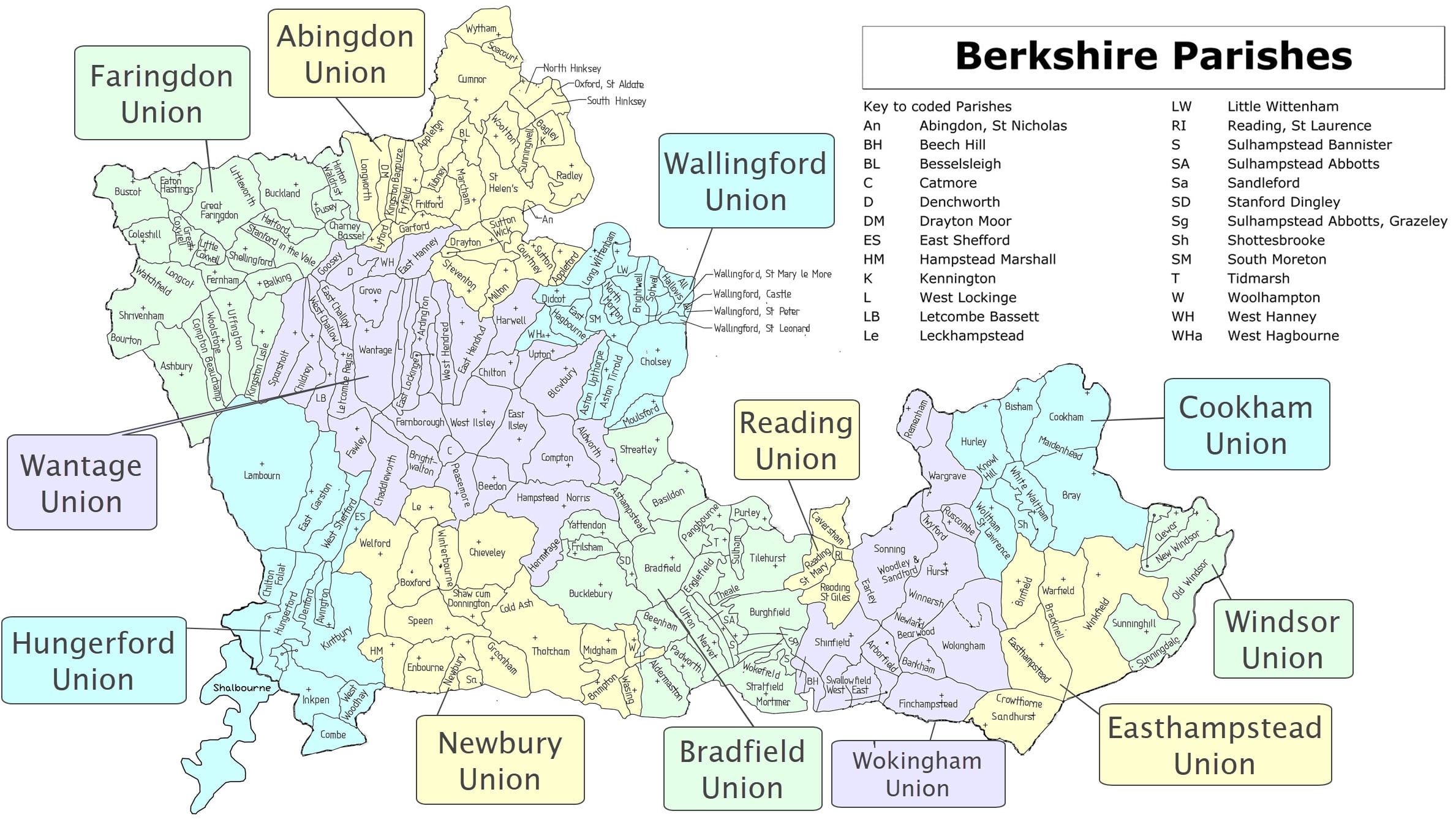
Wallingford Union is formed from the parishes of Aston Tirrold, Aston Upthorpe,Brightwell, Cholsey, Didcot, East Hagbourne, Little Wittenham, Long Wittenham, Moulsford, North Moreton, Sotwell, South Moreton, Wallingford St Leonard, Wallingford St Mary-le-More.
(swipe image left and right to show/hide map close-up)

Featured Places
Aston Tirrold and Aston Upthorpe
Aston Tirrold (sometimes spelt Tyrell) and Aston Upthorpe are adjoining villages just off the A417, about three miles south-east of Didcot,.
Brightwalton
Brightwalton is a wooded, agricultural village 12 miles north of Newbury and six miles south of Wantage, in the North Wessex Downs AONB
Brightwell-cum-Sotwell
Brightwell and Sotwell are twin villages between Wallingford and Didcot, lying in a hollow below the Wittenham Clumps.
Didcot
Didcot (19th C: Dudcott or Dudcote) is a town and civil parish about 10 miles south of Oxford. It was part of Berkshire until 1974
East and West Hagbourne
East and West Hagbourne lie in the Vale of the White Horse in northern (old) Berkshire, relocated since 1974 in Oxfordshire.
Little Wittenham
Little Wittenham is a village and parish on the right bank of the river Thames, three miles north-east of Didcot
Long Wittenham
Long Wittenham is a village and parish on the right bank of the river Thamesbetween Didcot & Abingdon
Moulsford
Moulsford is a Thames-side village and parish north of Streatley formerly the site of a river crossing by ford and ferry to South Stoke
North Moreton
North Moreton is a village and parish three miles east of Didcot. It lies on the line of a Roman road known as the Broadway
South Moreton
South Moreton is a village and civil parish about 3 miles east of Didcot and 4miles west of Wallingford, and was part of Berkshire until 1974
Wallingford
Wallingford is a Market town beside the Thames, on the edge of the Chilterns and Berkshire Downs with easy access to major roads
