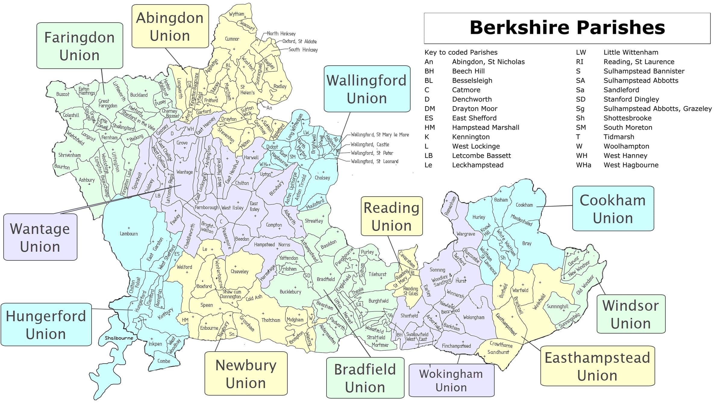
The Hungerford Union includes the parishes of Avington, Chilton Foliat, Denford, East Garston, East Shefford, Hungerford, Inkpen, Kintbury, Lambourn, Shalbourne, West Shefford and West Woodhay.
(swipe image left and right to show/hide map close-up)

Featured Places
Combe
Combe is a civil and ecclesiastical parish in the extreme south-west of Berkshire bordering Wiltshire & Hampshire, at the foot of Walbury Hill
East and West Shefford
East (also known as Little) Shefford and West (also known as Great) Shefford lie in the Lambourn Valley
East Garston
The parish & village of East Garston in W Berkshire is a five-mile strip of land and is one of a series of settlements on the river Lambourn
Hungerford
Hungerford is a small, historic, market town on the Berkshire/Wiltshire border, in the North Wessex Downs Area of Outstanding Natural Beauty
Inkpen
Inkpen is a village and civil parish in West Berkshire about 3.5 miles (5.6 km) south-east of Hungerford, bordering Wiltshire and Hampshire
Kintbury with Avington
Kintbury, an ecclesiastical and civil parish in W Berkshire between Newbury & Hungerford crossed by the river Kennet & the Kennet & Avon Canal
Lambourn
Lambourn, spelled with or without a u and with or without an e on the end lies in the valley of the river Lambourn in the Berkshire Downs
Shalbourne
Shalbourne is a village and parish consisting of Shalbourne or Town some distance from the hamlets of Bagshot in the north and Oxenwood in the south
West Woodhay
The civil and ecclesiastical parish of West Woodhay lies in the south west of Berkshire, on the northern slope of the Hampshire downs
